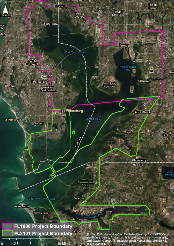
Dewberry, a privately held professional services firm, has announced that it has been awarded a task order under its indefinite delivery/indefinite quantity (IDIQ) contract with the National Oceanic and Atmospheric Administration’s (NOAA) National Geodetic Survey (NGS) to conduct shoreline mapping in Tampa Bay, Florida.
The task order consists of topobathymetric lidar and
imagery acquisition and processing, as well as shoreline mapping for nearly 230
square miles of southern Tampa Bay, Florida, including more than 580 linear
miles of shoreline. Deliverables will include lidar point cloud data,
topobathymetric digital elevation models, orthorectified imagery, geographic
cell shoreline, and associated metadata. In 2020, Dewberry conducted a similar
survey for NOAA to map 300 square miles of northern Tampa Bay.
Dewberry has deployed a water quality monitoring buoy in
Tampa Bay that logs water quality data every 15 minutes and sends the data to a
cloud server for instant access. This will allow the firm to monitor water
conditions in the bay during lidar and imagery acquisition, making sure data
are acquired in optimal water clarity conditions. Dewberry will also be on
board a Cessna Caravan aircraft operating the Coastal Zone Mapping and Imaging
Lidar (CZMIL) Nova lidar sensor during acquisition. A concurrent ground survey
will be conducted to acquire control points and independent checkpoints used
for vertical and horizontal accuracy. The lidar and imagery data will be used
primarily for shoreline compilation and attribution to be ingested into
navigation charts. Data acquisition is expected to be completed by the second
half of 2021, with deliverables being presented throughout 2021.
“We have leased Teledyne Optech’s CZMIL Nova
topobathymetric lidar sensor to acquire data for this project. The sensor has a
unique deep channel feature that will allow for bathymetric bottom returns
deeper than we would expect to achieve with topobathymetric lidar sensors
available,” says Dewberry Associate and Project Manager Emily Klipp. “I am
excited to be managing this important project to support NOAA and the entire
coastal community with high resolution topo-bathymetric lidar and imagery.”