
Skip to Content

Dewberry Selected by NOAA and BOEM to Implement Cloud Architecture for Automatic Identification System Data

New delivery system to provide access to area of interest within specified date range and geographic extent.

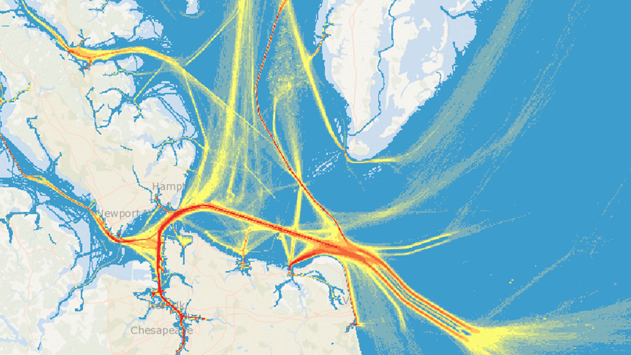
2017 AIS vessel traffic in Chesapeake, Virginia. Image courtesy of Dewberry.

The National Oceanic and Atmospheric Administration (NOAA) and the Bureau of Ocean Energy Management (BOEM) has selected Dewberry to implement a new system that will allow the public to access the U.S. Coast Guard’s Automatic Identification System (AIS) vessel data in a cloud-based and map-centric platform. Users will continue to access AIS data via MarineCadastre.gov and be able to select and download regions and periods of data.

AIS generates data that is then collected, processed, archived, and distributed freely to the public via NOAA’s Marine Cadastre Project. The platform’s design was completed by Dewberry in May 2020 to include custom data orders that reflect specific areas of interest and time periods. This backend cloud environment is the first for NOAA and serves as a prototype for other applications to be migrated to the cloud. The new online resource will feature a modern geospatial viewer to locate, filter, and download the AIS data of interest.

“We enjoy a collaborative development partnership with NOAA. Our teams of geospatial, software and system development, data science, and engineering professionals join in this important work,” says Dewberry Project Manager Ken Logsdon, Jr., PMP, GISP, ENV SP. “It’s exciting that we get to help steward and bring insight to our nation’s resources.”


Related Insights

Our approach combines a ground-based camera and traditional survey equipment to collect accurate data without physical contact with energized assets.

August 27, 2026

For decades, utilities have relied on mechanical calipers to measure transmission wire diameters. However, this approach requires survey crews to either climb transmission towers or maneuver heavy bucket trucks into energized zones, creating significant safety risks, operational challenges, and…

Blog

Integrating lidar and other 3D data into GIS gives utilities a detailed view of terrain and infrastructure, enabling more accurate transmission line and substation design, clearance analysis, and project planning.

August 20, 2026

Electric power utilities face many challenges today — rising power and supply chain costs, sharply increasing demand from large loads like data centers, major changes in federal energy policies, and a growing imperative to invest in grid hardening and resilience.

Blog

Dimensions®

Our annual review and corporate social responsibility report, in one place.