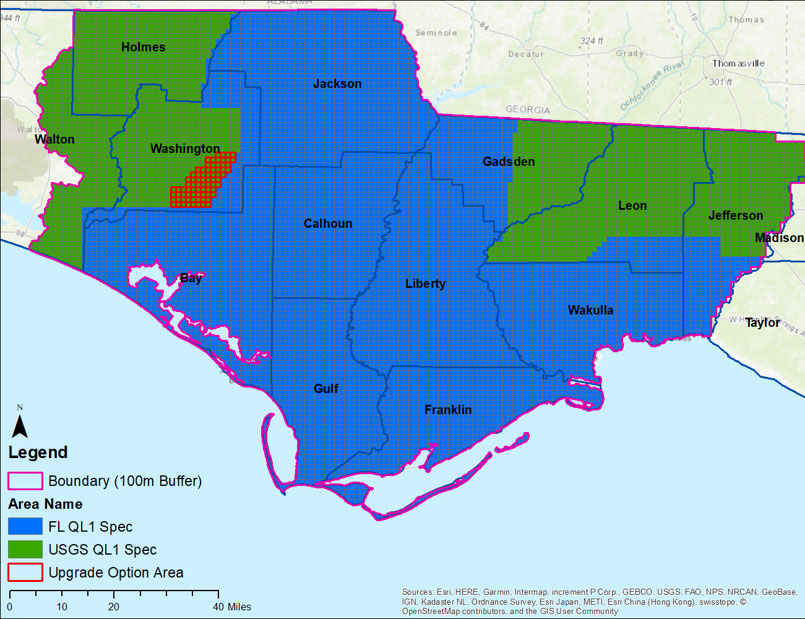
Dewberry, a privately held professional services firm, announced that it has been selected by the U.S. Geological Survey (USGS) to provide updated base elevation models for the panhandle region of Florida, which was heavily impacted by Hurricane Michael in 2018.
The firm has collected data for approximately 8,000
square miles of Florida, including the counties of Washington, Bay, Jackson,
Calhoun, Gulf, Gadsden, Liberty, Franklin, Leon, Wakulla, and portions of
Walton, Holmes and Jefferson. The data will be processed to quality level 1
(QL1) specification requirements, which is >8 points per square
meter, with roughly 5,700 square miles at the Florida enhanced hydrography QL1
specification requirements and the remaining 2,550 square miles at the USGS
National Geospatial Program Lidar Base Specification version 2.1.
“We are thrilled to help USGS, partner federal agencies,
and the state of Florida work toward achieving their goal of procuring
statewide QL1 Lidar coverage with enhanced hydrographic specifications for
storm surge modeling,” says Dewberry Project Manager Emily Klipp. “With these
data, federal and state officials and safety experts will be better informed
when determining climate adaptation strategies.”