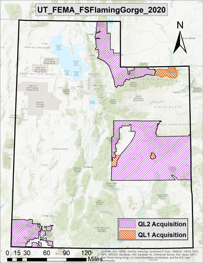
Dewberry has announced that it has been awarded a contract by the U.S. Geological Survey (USGS) to map roughly 13,600 square miles of land in Utah, and analyze the produced data.
Dewberry will collect lidar data across Emery, Carbon,
Grand, Cache, Weber, Morgan, Summit, Dagget, Uintah, Duchesne, Iron, and
Washington counties during the fall and winter seasons of 2020 through May
2021. This project will support the USGS 3D Elevation Program (3DEP); the
Federal Emergency Management Agency’s (FEMA) Risk Mapping, Assessment, and
Planning (MAP) program; the National Resources Conservation Service high
resolution elevation enterprise program; the U.S. Department of Agriculture
Forest Service conservation and management of watersheds; and resources related
to the Collaborative Forest Landscape Restoration Program.
“Increased development, urbanization, and the effects of
global climate change have resulted in the need for up-to-date information,”
says Dewberry Project Manager and Senior Associate Elise MacPherson, PMP. “This
project will help USGS, FEMA, and other partner agencies acquire baseline
elevation data at the required accuracy and resolution to protect our natural
resources and provide thousands of residents with updated reference data that
they can use to keep their families and property safe.”