I recently attended a training about pairing an emerging technology, drone imagery, with Esri’s ArcGIS mapping platform. What’s exciting about this combination is that mapping information of live project sites can now be easily augmented by drone imagery. As a civil engineer, I use other technologies like AutoCAD Civil 3D and surveying measurements to map sites for our clients. It seems likely to me that we’ll soon be using drone imagery and mapping software to do this work in the future. The only difference is that this technology will deliver projects to our clients in less time and with more savings.
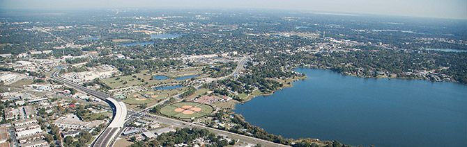
John Young Parkway aerial photography
Drone Imagery Advantages
After learning about the capabilities of partnering drone imagery with mapping software, I can identify a number of ways that it can be applied to my work. Flying a drone for aerial survey photos would help us create a quick model of the surface so that we could efficiently develop preliminary site plans. This would assist us in presenting land planning options to our clients in a much faster, and possibly more accurate, way. Drone imagery may also highlight critical design considerations much earlier than previously possible, saving us time. Furthermore, time can also be saved as imagery of the site will be available from the onset of the project, limiting the need for multiple site walks.
Using this mapping technology to format drone imagery will help us review 3-D plans of the site, giving us the ability to showcase exactly where pipe, structural areas, and other features will be and provide us with a quick model to continually refine our products. With more information at our disposal, we’ll be able to keep pace with even the most aggressive project timelines and evolutions, saving our clients time and money.
This is also an important technological advantage to keep in mind when reviewing environmental impacts of the planned project in case it’s near a wetland or other sensitive area. We’ll be able to display a comprehensive picture of exactly how our design elements will impact the area’s surrounding natural elements.
Regulatory Hurdles
However, while we are the forefront of a new technological emergence, regulations will need to quickly evolve to ensure that drone technology is implemented in a safe and efficient manner. While drones are capable of navigating themselves over great distances, there are still many safety concerns to be addressed. The Department of Transportation, Federal Aviation Administration, and National Aeronautics and Space Administration all recognize this and are working closely with a private-sector task force, made up of companies like Google, Amazon, and Walmart, to come up with solutions and standards on how to best regulate this emerging technology.
I look forward to seeing how drone regulation unfolds and will continue to look for new opportunities to implement technologies in my engineering work. I hope that someday we’ll be able to use this technology to advance civil engineering.
Learn about how our site/civil engineers are using civil BIM to showcase complex information in a familiar way.