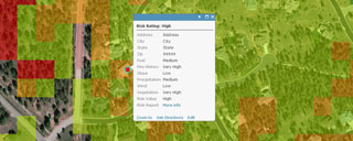
Dewberry has announced the development of the Wildfire Risk Model, a new tool that incorporates dozens of layers of geospatial information to assess risk due to wildfires. The tool is designed to aid communities, state and federal agencies, insurance companies, and homeowners in assessing property risk and developing mitigation plans.
The Wildfire Risk Model provides risk detail at a 30-meter resolution, allowing for address-level assessments. The program assesses a broad range of elements that impact risk, including fuel, weather, slope, topography, wind patterns, and fire history.
Myriad Development, Inc. recently integrated the new model into its market-leading Risk Manager insurance underwriting platform. Myriad CEO Chris Roussel states, “Myriad customers can utilize the wildfire model within their point of sale, underwriting and in force management workflows on the Myriad platform. The model provides another valuable underwriting decision variable that is easily integrated into the customers’ existing processes.”
“Climate change and the urbanization of forested areas have increased the occurrences of wildfires in the U.S., putting more properties at risk,” says Laurel McGinley, senior associate at Dewberry. “The Wildfire Risk Model will help communities and companies identify the local level of risk and identify strategies to mitigate risk.”
About Myriad Development, Inc.
Myriad Development, Inc. is a leading provider of underwriting decision support technology and information to the Property & Casualty, Government Agency and Real Estate Services markets for more than a decade. The company has been recognized by both Inc. Magazine and Deloitte as one of the Fastest 500 growing privately held companies in the nation. To learn more, visit www.myriad-development.com.