Headwaters Drainage Study
Advancing Local Stormwater Management and Flood Resilience
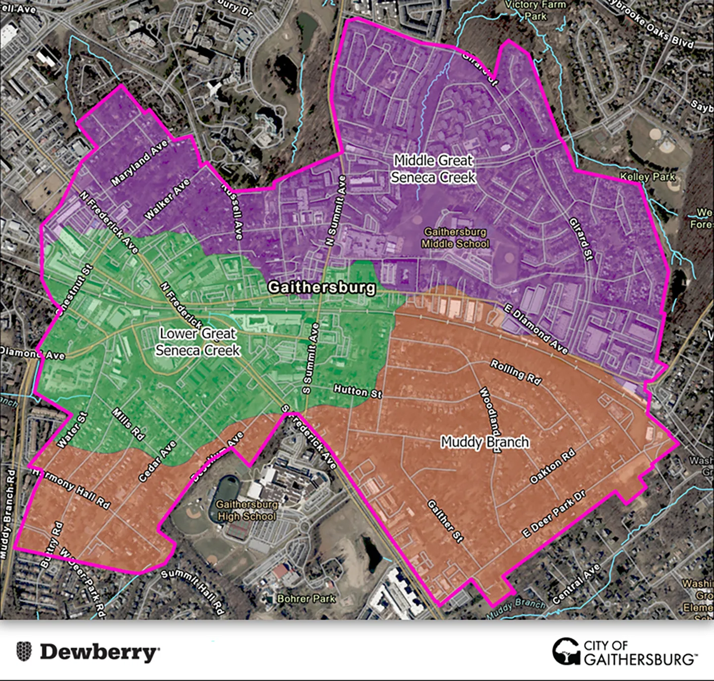
Map of the study area boundary and evaluated watersheds.
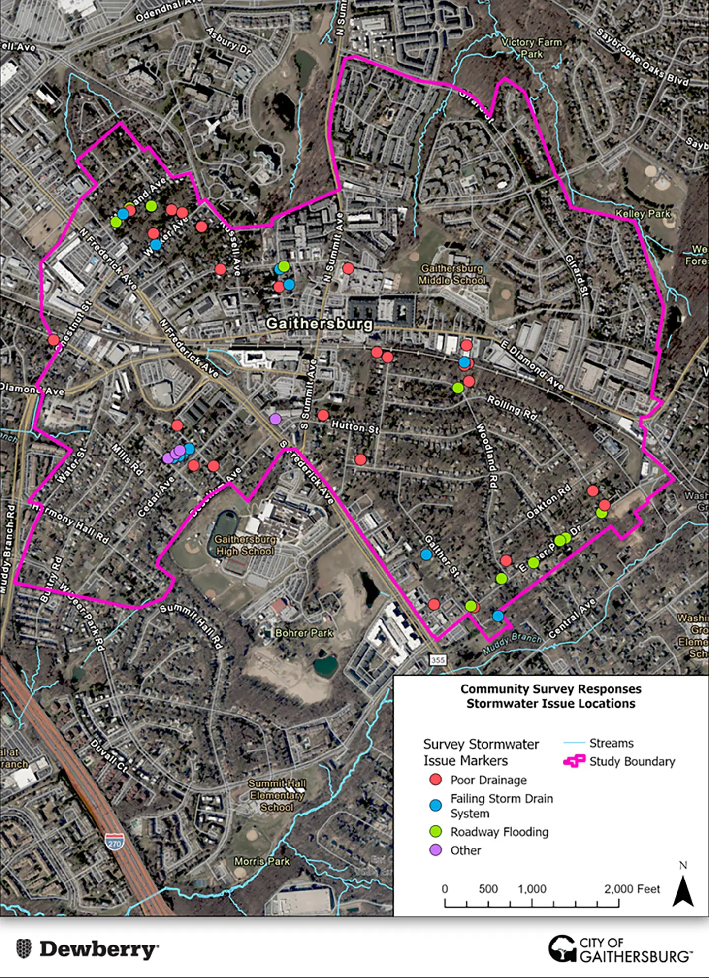
Map of online survey responses.
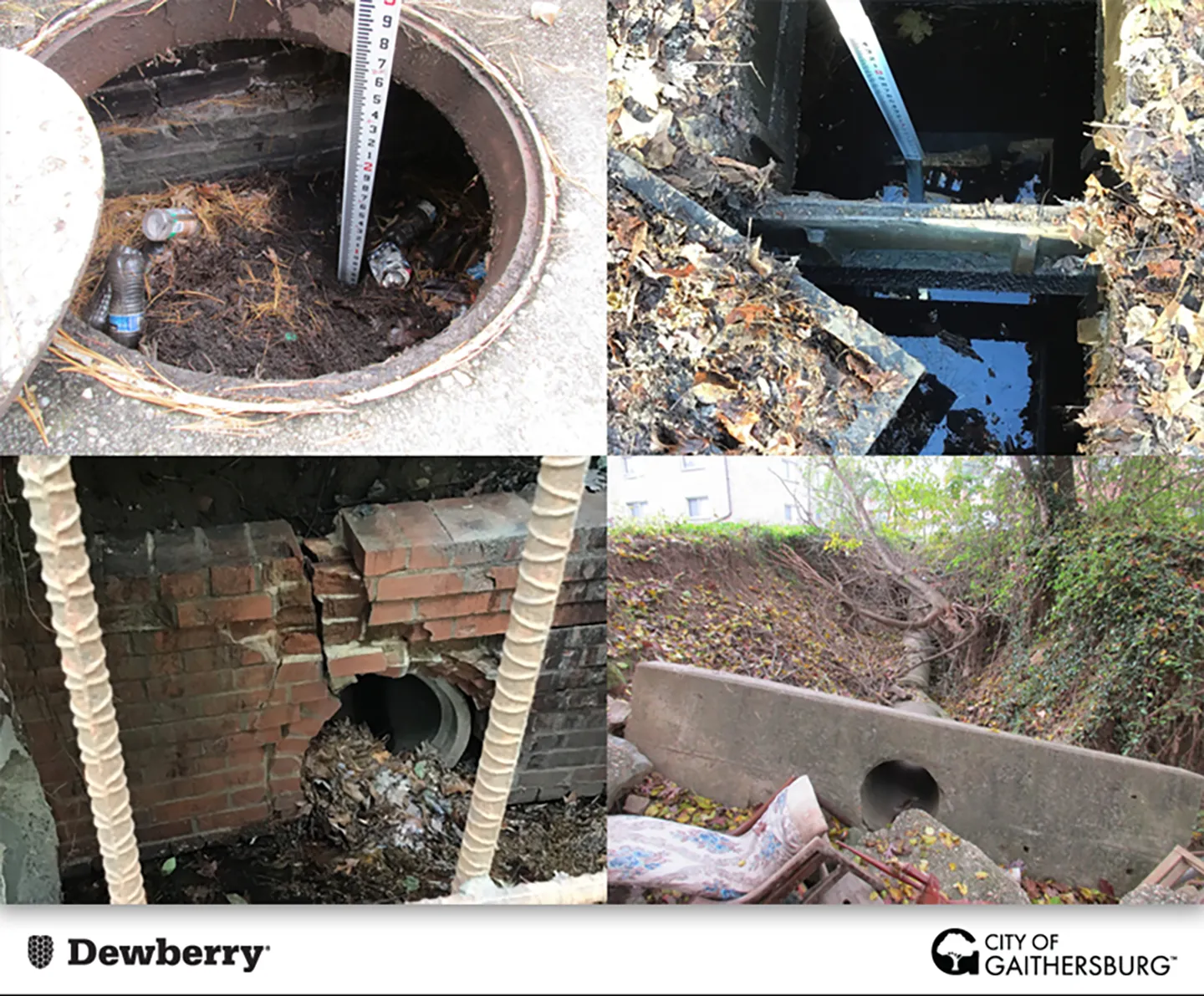
Documented findings from field investigations.
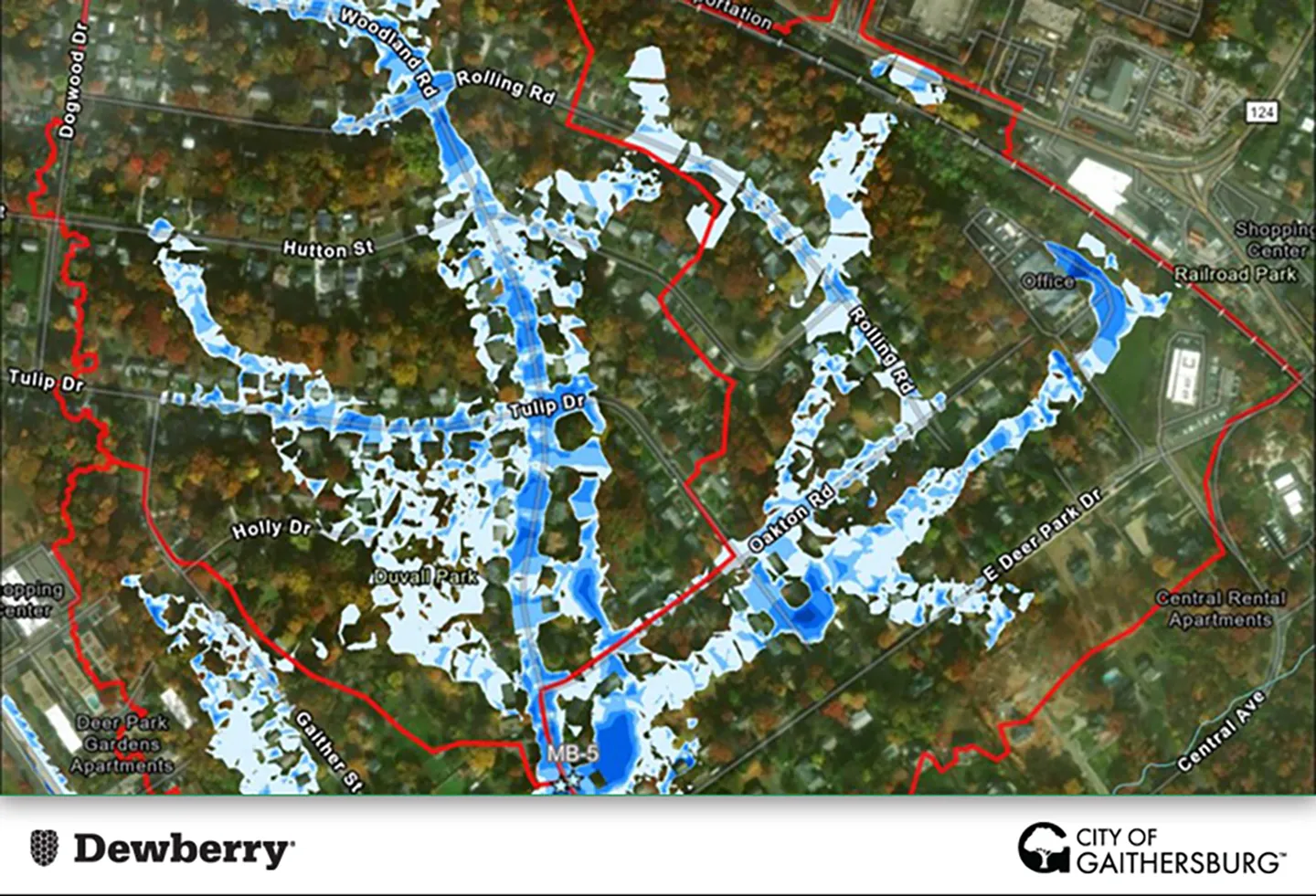
Future condition model results for a 25-year, 24-hour storm event in Gaithersburg, Maryland.
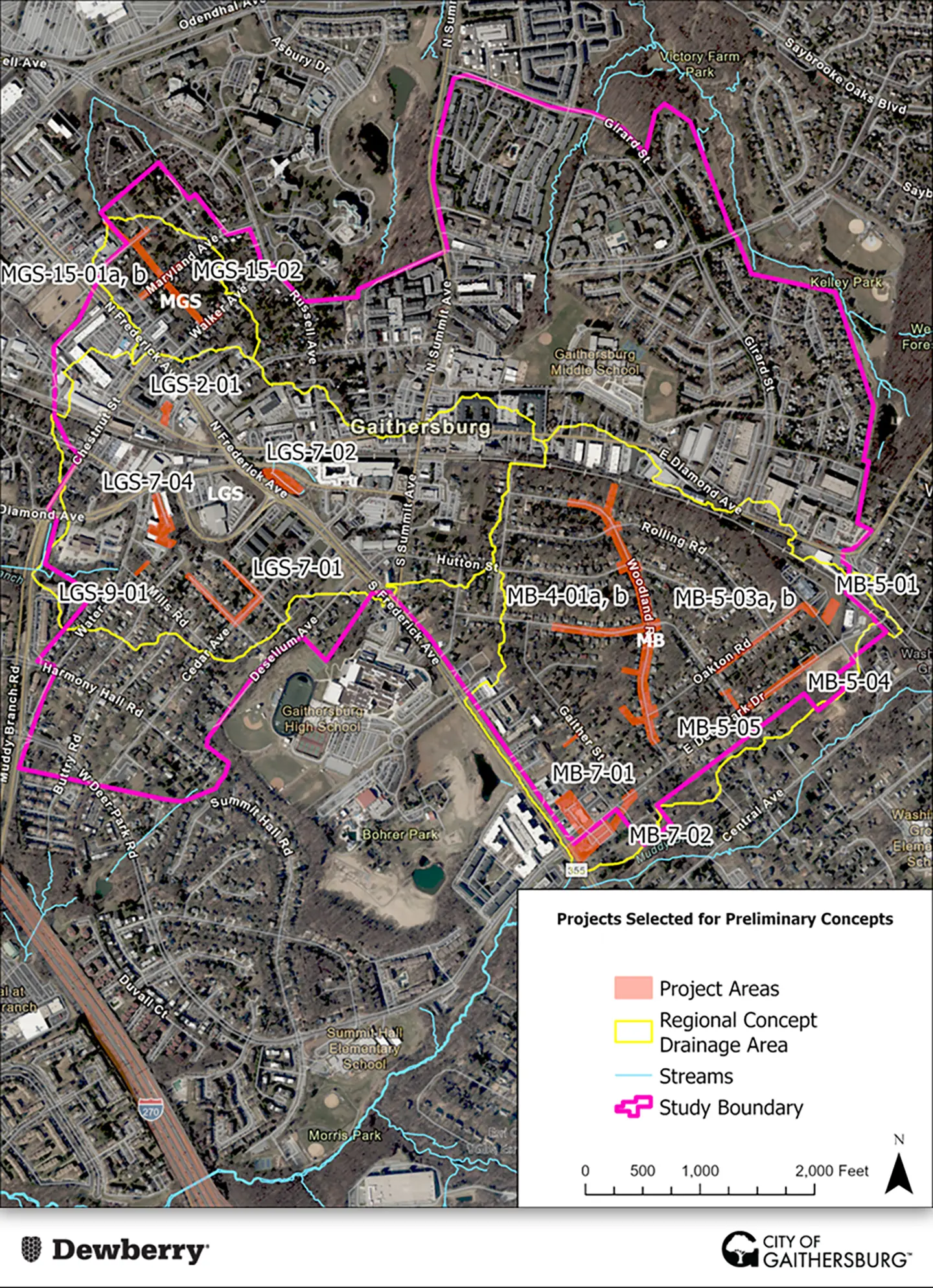
Map of the 14 concept-level projects identified from the study.
- Client/Owner
- City of Gaithersburg
- Location
- Gaithersburg, MD
- Cost
- $273,000
- Completed
- 2024
- Region
- Mid-Atlantic
To address recurring stormwater management and flooding challenges, our team conducted a watershed study for the City of Gaithersburg across a 740-acre area, spanning the headwaters of the Muddy Branch, Lower Seneca Creek, and Middle Seneca Creek watersheds. The study combined community input, field investigations, geographic information systems (GIS) analysis, and pluvial modeling to identify and prioritize stormwater improvements and support development of projects for the city’s capital improvement program (CIP). Once implemented, these improvements will strengthen neighborhood-level stormwater infrastructure and enhance long-term climate resilience.
Community engagement played a central role in this study. Our team distributed a bilingual online survey to gather input on recurring flooding concerns, stormwater impacts, and perceived gaps in existing drainage infrastructure. Community feedback helped inform project priorities and identify issues.
Following survey collection, we completed a desktop analysis using GIS data on existing stormwater infrastructure, impervious surfaces, and known drainage concern locations. This analysis identified stormwater points of investigation and associated drainage areas for additional field evaluation.
Field investigations assessed the condition and performance of stormwater infrastructure and existing best management practices. The team documented maintenance concerns, structural deficiencies, and potential restoration opportunities, while also capturing any unmapped infrastructure to update the city’s stormwater GIS database.
To further evaluate flood risk, our team developed a hydrodynamic model using the personal computer stormwater management model (PCSWMM). The model combined one-dimensional and two-dimensional flow components to simulate underground pipe systems and overland flooding during 10-year and 25-year storm events under both existing and future climate conditions.
Working closely with the City of Gaithersburg, we developed a prioritization matrix to evaluate project opportunities based on a combination of social, environmental, and economic metrics, including public safety, flood mitigation potential, water quality benefits, and cost effectiveness. This process incorporated field observations, modeling data, survey input, and feedback collected through three community meetings held throughout the study.
Ultimately, the team advanced 14 projects for concept development, including stormwater infrastructure upgrades, retention and detention basins, and green infrastructure solutions such as bioswales and bioretention systems. Projects were organized into three watershed-based concepts to maximize cumulative benefits and were supported by preliminary cost estimates and conceptual designs for phased implementation through the city’s CIP.
To learn more about the study, head to the project’s interactive storymap developed by the project team.
740
acre study area
14
concept-level projects identified
Awards
-
Merit Award, 2026 Engineering Excellence Awards
American Council of Engineering Companies (ACEC) Maryland