Mapping Alaska—America’s Last Frontier
Updating Alaska’s Digital Elevation Data to USGS 3DEP Standards
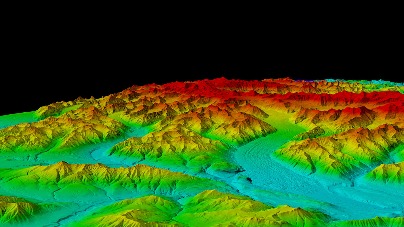
Many of the valleys shown here have near perpetual cloud cover, but were successfully mapped using IFSAR technology.
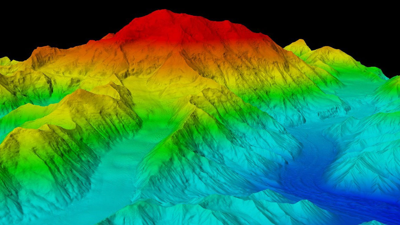
The previous elevation of Denali of 20,320 feet has now been revised to 20,310 feet. Snow and ice at the peak was calculated at 6.1 meters (approximately 20 feet) through the use of ground-penetrating radar.
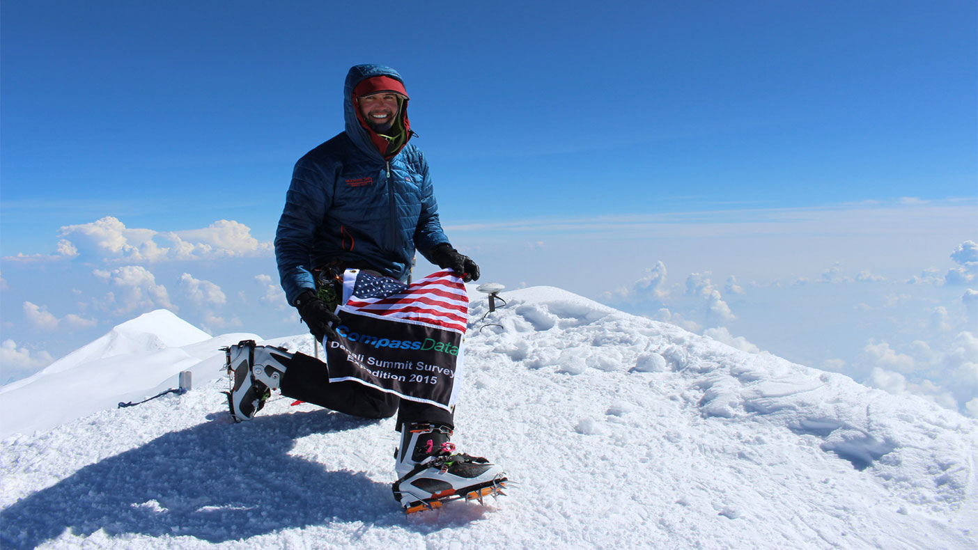
Blaine Horner, survey party chief with CompassData at the summit on June 24, 2015, places a GPS antennae at the summit of Denali for future data collection.
- Client
- USGS Alaska Statewide Digital Mapping Initiative
- Owner
- USGS and numerous funding partners
- Location
- AK
- Services
- Geospatial, Mapping, and Survey, Technology
- Markets
- Federal
- Square Mileage
- 663,684 SM (completed to date)
- Cost
- $66.32 million
- Completed
- Ongoing
- Region
- West
In 2008, we were faced with the challenge of mapping Alaska, the only state with no digital orthophotos or other forms of mapping. We approached this challenge by recommending consistent statewide standards for our client and developed the Alaska DEM White Paper, which advised the use of interferometric synthetic aperture radar (IFSAR) for the elevation layer that serves as the base map for all other mapping layers. The white paper, and our subsequent National Enhanced Elevation Assessment (NEEA) report for the U.S. Geological Survey (USGS), provided the blueprint for the USGS mapping of Alaska to QL5 standards for its 3D Elevation Program (3DEP). We began mapping the state in 2010 and completed the project in 2020, with the final datasets covering the Western Aleutians. For the IFSAR mapping, we tapped two subcontractors: Intermap Technologies from Denver, Colorado, and Fugro EarthData from Frederick, Maryland. JOA Surveys, of Anchorage, Alaska, surveyed QA/QC checkpoints statewide.
As the prime contractor, we managed the ground surveys and IFSAR data collection mapping flights required to update the digital elevation model, and performed detailed QA/QC to obtain first-time acceptance of all deliverables in various file formats for different clients. The project included a GPS survey to obtain a new elevation for Denali (formerly Mt. McKinley). In order to obtain accurate GPS data for Denali, we assembled a team of surveyors from Denver-based CompassData along with a scientist from the University of Alaska-Fairbanks to climb the mountain with extensive GPS equipment and supplies for the summit. The trip, sponsored by USGS and the National Oceanic and Atmospheric Administration’s (NOAA’s) National Geodetic Survey (NGS), was followed a year later by a second climbing expedition to use ground-penetrating radar (GPR) to survey the depth of the ice and snow at the peak. We also completed several pilot projects using Alaska’s ifsar, and produced, for example, an elevation-derived National Hydrography Dataset (NHD) and NHD Plus products.
3
statewide models