USGS Everglades National Park Lidar
Helping Understand the Diverse Habitats and Characteristics of the Everglades
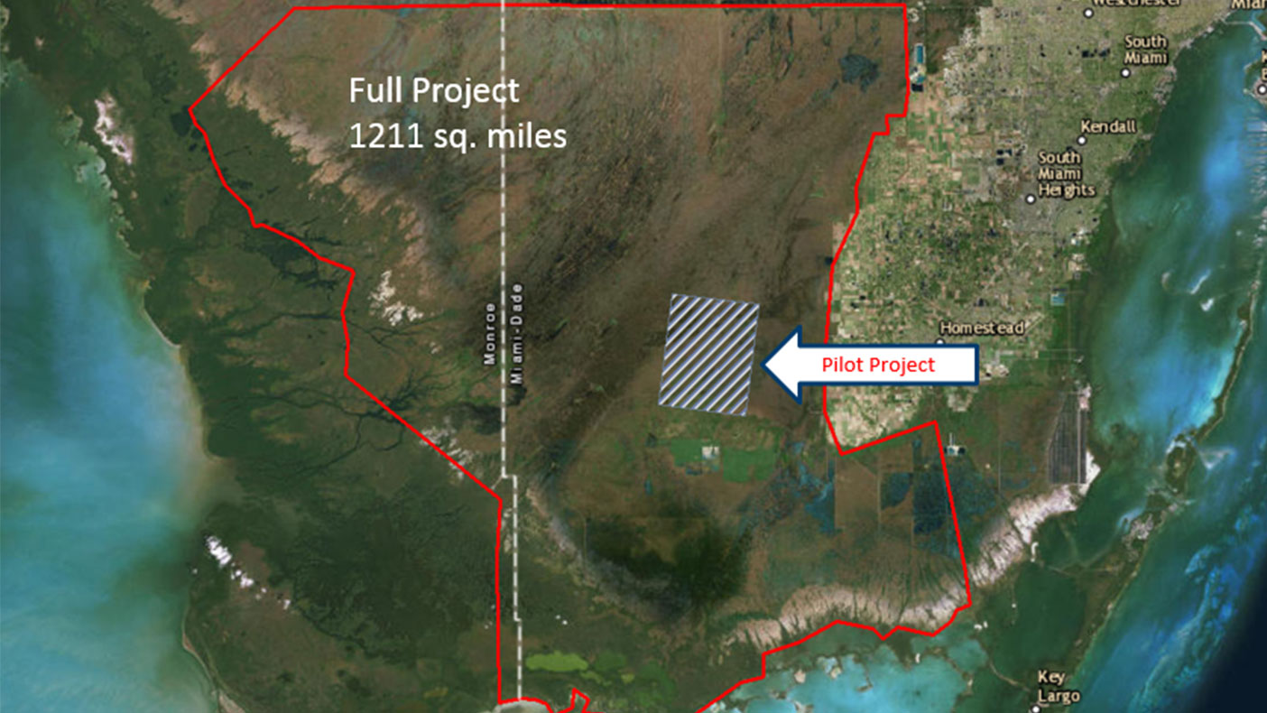
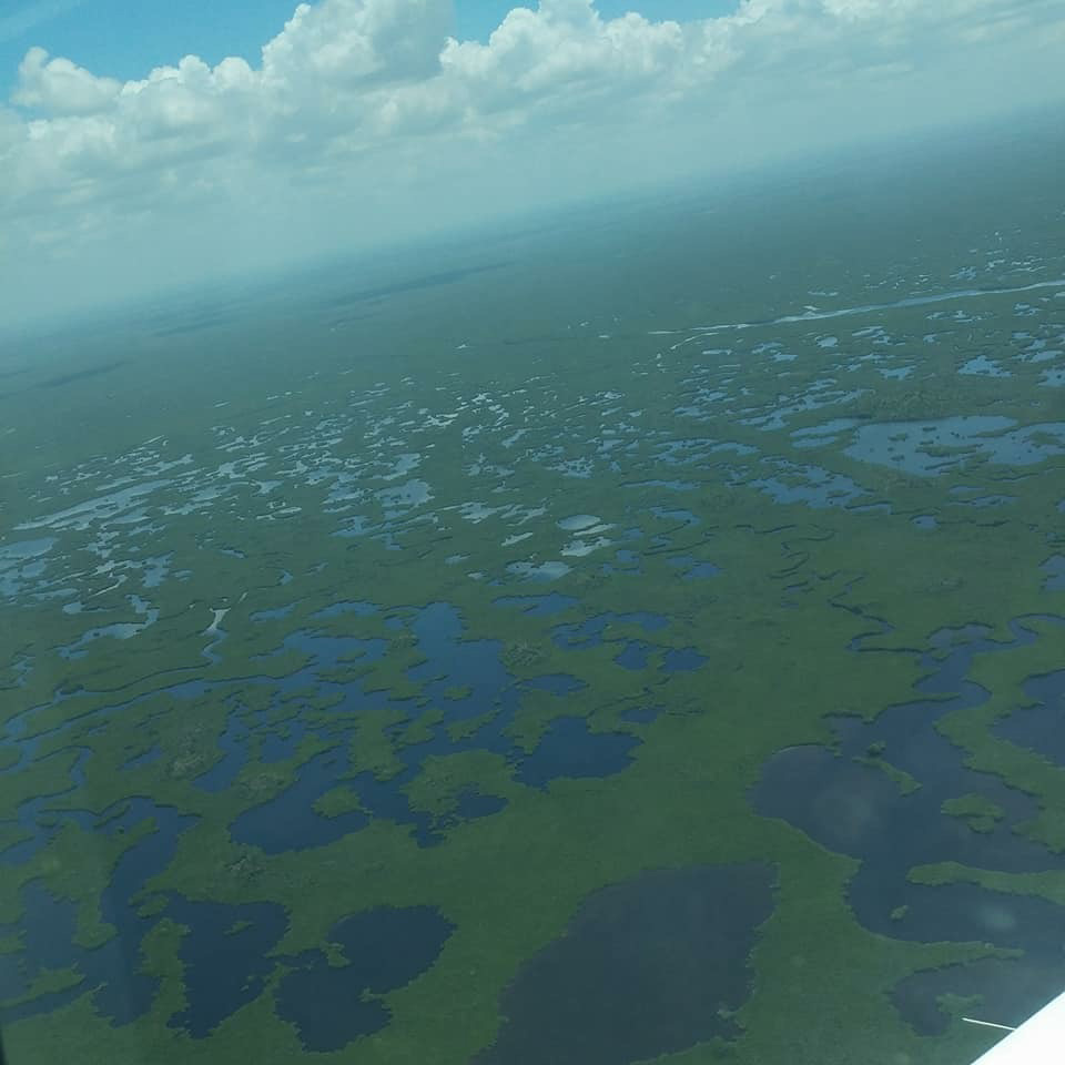
We’re covering 1,211 square miles within the Everglades National Park to produce elevation data for the unique environment.
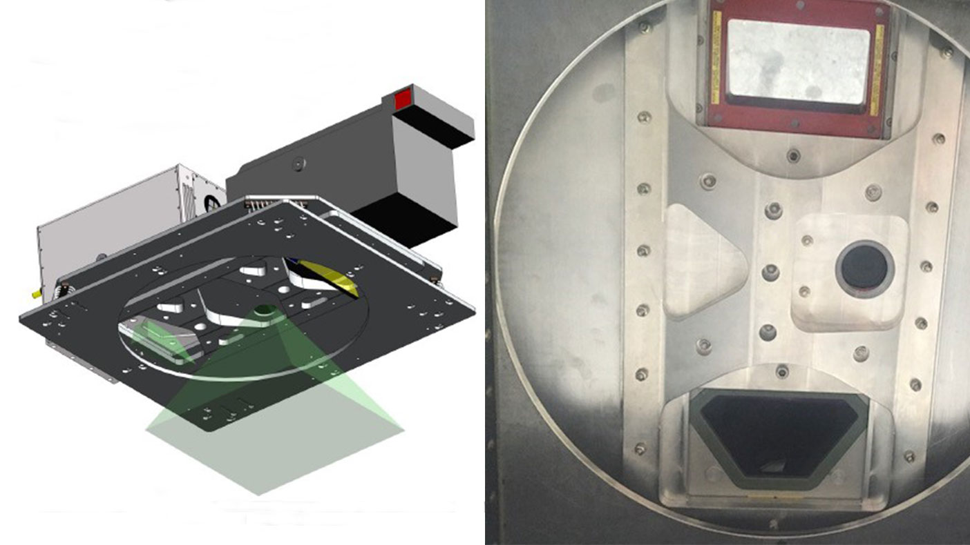
L: Engineering model illustrating the install of the lidar and imagery sensors (image courtesy Leading Edge Geomatics). R: Sensors installed on the mounting plate in the Piper Navajo aircraft.
- Client
- USGS Geospatial Products and Services Contract (GPSC)
- Location
- Florida, FL
- Services
- Geospatial, Mapping, and Survey
- Completed
- Ongoing
- Region
- Southeast
In April 2016, we were awarded a task order from the U.S. Geological Survey (USGS) for a pilot project to test and evaluate lidar remote sensing necessary to produce elevation data covering the unique environments within the Everglades National Park. After delivering the pilot data to USGS and the National Park Service (NPS), our recommendations were approved, and we were awarded a task order to collect and process lidar over a 1,211-square-mile area within the park.
Lidar data were acquired when water levels within the park were historically low. Based on results from the pilot study, our team, supported by our subcontractor Leading Edge Geomatics, co-mounted a Riegl VQ820G topobathymetric lidar sensor, a Riegl LMS Q680i topographic sensor, and a small digital camera in a Piper Navajo aircraft. By utilizing this unique multi-sensor, high-density topobathymetric lidar technology, we were able to acquire both terrestrial near-infrared wavelength and submerged green-wavelength topography data. Prior to collection, extensive ground surveys were performed to calibrate and test the lidar. The data collected will be used to assist USGS and NPS in environmental management of the park, including initiatives to address sea level rise, and help increase the predictive capability of hydrologic models and improve understanding of the park’s diverse habitats and drainage characteristics.
Related Projects

- Location
- Nationwide

- Location
- St. Louis, MO
- Market
- Federal
- Location
- Nationwide
- Location
- San Joaquin County, CA
- Location
- Louisa, VA
- Location
- Channel Islands National Park, CA